Skip to main content Skip to footer Sitemap

Trail of the Seven Churches in Brixen

Brixen
Add to favourites
Difficulty
Easy
Duration
2:46
in hours
Distance
8.8
in km
Status
open
Categories
  • Theme paths
  • Family hikings
Suggested period
Jan
Feb
Mar
Apr
May
Jun
Jul
Aug
Sep
Oct
Nov
Dec

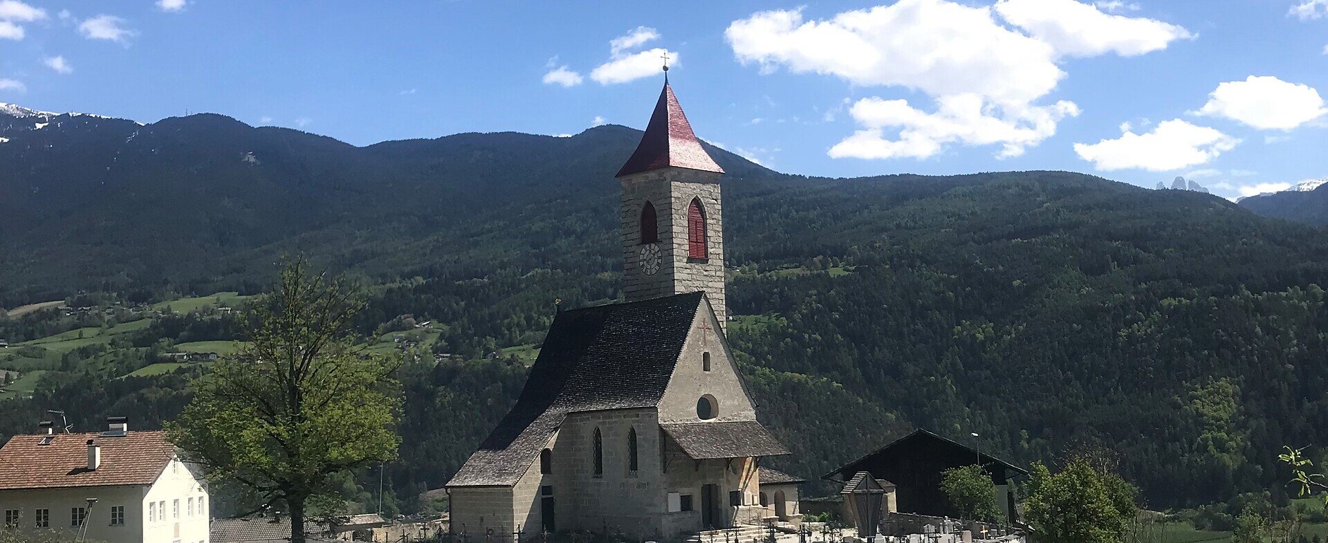
This contemplative cultural/historical hiking circuit on the Pfeffersberg mountain spans the seven churches above Brixen/Bressanone, testifying to the deep Christian beliefs of the local population. On the third Sunday of September, the annual pilgrimage is held in the church district of Brixen, known as the “Seven Church Procession”.
Gallery
Further information and useful links

From the Wirt an der Mahr Inn south of Brixen, follow trail no. 10 which leads to the Church of St. Jakob. From there, continue to Tschötsch/Scezze to the Church of St. Clemens. Then, take trail no. 11 and pass the Höfestraße street to the ditch. Ascend uphill along trail no. 10, crossing Feldthurner Straße street (LS 74) and continue about 100 m as far as Tötschling/Tecelinga, where there’s the Church of St. Johann. Proceed north along Höfestraße street on trail no. 10 until you come to the picturesque Church of St. Nikolaus, in the field on the right-hand side. Continue north over Höfestraße street and cross the bridge over the canal to the Saderhof farm. Follow the Panoramastraße panoramic road to the Church of St. Vitus in Tils/Tiles. Return down the paved road (trail no. 8) to the Church of St. Cyrillus. Follow the Keschtnweg (Chestnut Trail) before reaching the Church of St. Ulrich in Pinzagen/Pinzago. Head south along the dirt road as far as the sportsground and turn left to the Haidnerhof farm. Descend into the valley through the woods across the Bärenbachgraben ditch and back to the Mahr, from where the hike started.

Categories
  • Theme paths
  • Family hikings
Route data
Easy
Distance
8,8 km
Duration
2 h 46 min
Ascent
455 m
Decent
455 m
Technical skills
Physical condition
Scenary
Highest point
916 m
Lowest point
550 m
You might be interested in
Discover related tours
Latzfons | © Tobias Kaser
Intermediate
Add to favourites
Klausen
Round trail three villages (Latzfons - Garn - Verdings)
Distance 7,7 km
Duration 2 h 18 min
Ascent 304 m
Decent 308 m
Status
open
nature solarium | © Hannes Niederkofler
Intermediate
Add to favourites
Gitschberg Jochtal
Sunshine refill spot at Gols in Terenten
Distance 6,2 km
Duration 2 h 17 min
Ascent 580 m
Decent 10 m
Status
open
Puntleider / Pontelletto lake | © Brixen Tourismus Gen
Intermediate
Add to favourites
Brixen
From Grasstein to Puntleider lake
Distance 10,2 km
Duration 3 h 47 min
Ascent 990 m
Decent 990 m
Status
open
Gitschberg Jochtal
The Witches' Stone in Terenten
Distance 1,8 km
Duration 46 min
Ascent 219 m
Decent 0 m
Status
open
Gitschberg Jochtal
Ywein trail
Distance 1,5 km
Duration 40 min
Ascent 100 m
Decent 52 m
Status
open
Fundres/Pfunders | © Gitschberg Jochtal
Intermediate
Add to favourites
Gitschberg Jochtal
Pfunders Farm trail
Distance 5,9 km
Duration 3 h 30 min
Status
open
Where?
When?
Who?
Rooms
1